PREVIOUS PROJECTS
Mezzanine Survey
A Manganese mine was experiencing difficulties with flow rate, liner wear and Practicality of having a chute system underground.
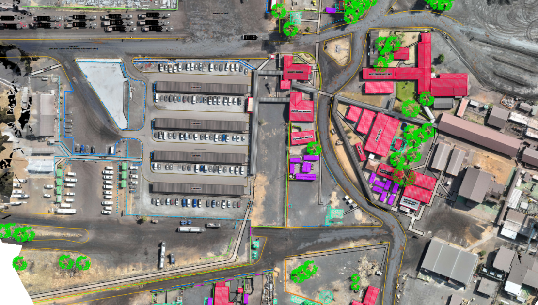
Our survey team expertly conducted a comprehensive UAV survey of the mining offices, utilizing advanced Emlid Reach survey equipment. To guarantee the highest level of accuracy, we strategically deployed five Ground Control Points (GCPs) across the site. The data collected was meticulously processed using specialized surveying software, culminating in the delivery of a highly detailed DXF file to the client. Such surveys are indispensable for providing precise and reliable data, which is critical for effective planning, development, and operational efficiency in mining projects. Accurate surveys minimize risks, optimize resource allocation, and ensure compliance with regulatory standards.
Recommended Articles
-
Manganese Mine Changing Room
6 years ago639 views -
Static Grizzly Tipping Bin
6 years ago629 views -
Drizit – Oil Separation Plant
6 years ago577 views -
Tunnel Chute
6 years ago700 views -
Mezzanine Survey
12 months ago867 views -
Benefits & Challenges of being on the forefront of technology in business
2 years ago763 views


